
PolarCode App
Voyage planning information at your finger tips. Know what ice conditions lie ahead for safe Arctic navigation.
Voyage planning information at your finger tips. Know what ice conditions lie ahead for safe Arctic navigation.
Download latest ice conditions, request new updates while at sea, or pre-download before voyage.
To comply with the Polar Code, increase safety, and minimize environmental impacts.
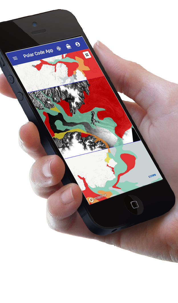
Download and view latest available Sea Ice Charts
Look at latest satellite imagery of Ice conditions
New Ice Drift and Ridge Products that highlight ice concentrations and thickness indication.
Use the internet to get the latest data in near-real-time.
Download latest information before voyage in event internet services unavailable during voyage.
Based on your vessel type you can display your Polaris risk.
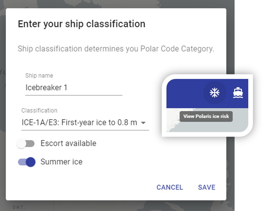
Configure application to show Polaris Risk based on your ships classification.
Enter Ice Class information about each of your vessels.
Upload routes to validate whether you Vessel is capable of navigating sea ice conditions in planned route before you leave port.
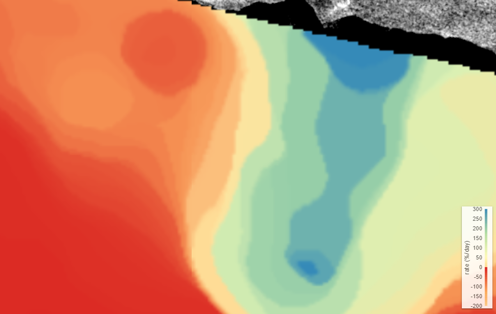
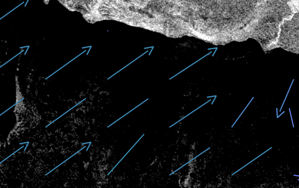
Know where Ice Ridges to avoid Ice Damage.
Maps of ice ridges help Captains navigate around damage inducing ice ridges.
Know where Ice Ridges to avoid Ice Damage.
Ice drift direction and velocity aid captains predict where the ice be and if ridges will form or dissapate.
This short video provides a great summary of Polar Code Requirements
This short video provides a great summary of Polar Code Requirements